
The Joseph Dow trunk archive · Document gallery 70
Lot 3E: navigation exercises and a worked sailing journal
25 photographs · 7 document groups
Photographed by Whit from the recovered Joseph Dow collection. Descriptions draw on visible names, dates and subjects; uncertain readings remain provisional. Reading copies are turned upright, and each image links to the unchanged full-resolution original.
JDT-D531 · A navigation notebook and an introductory problem
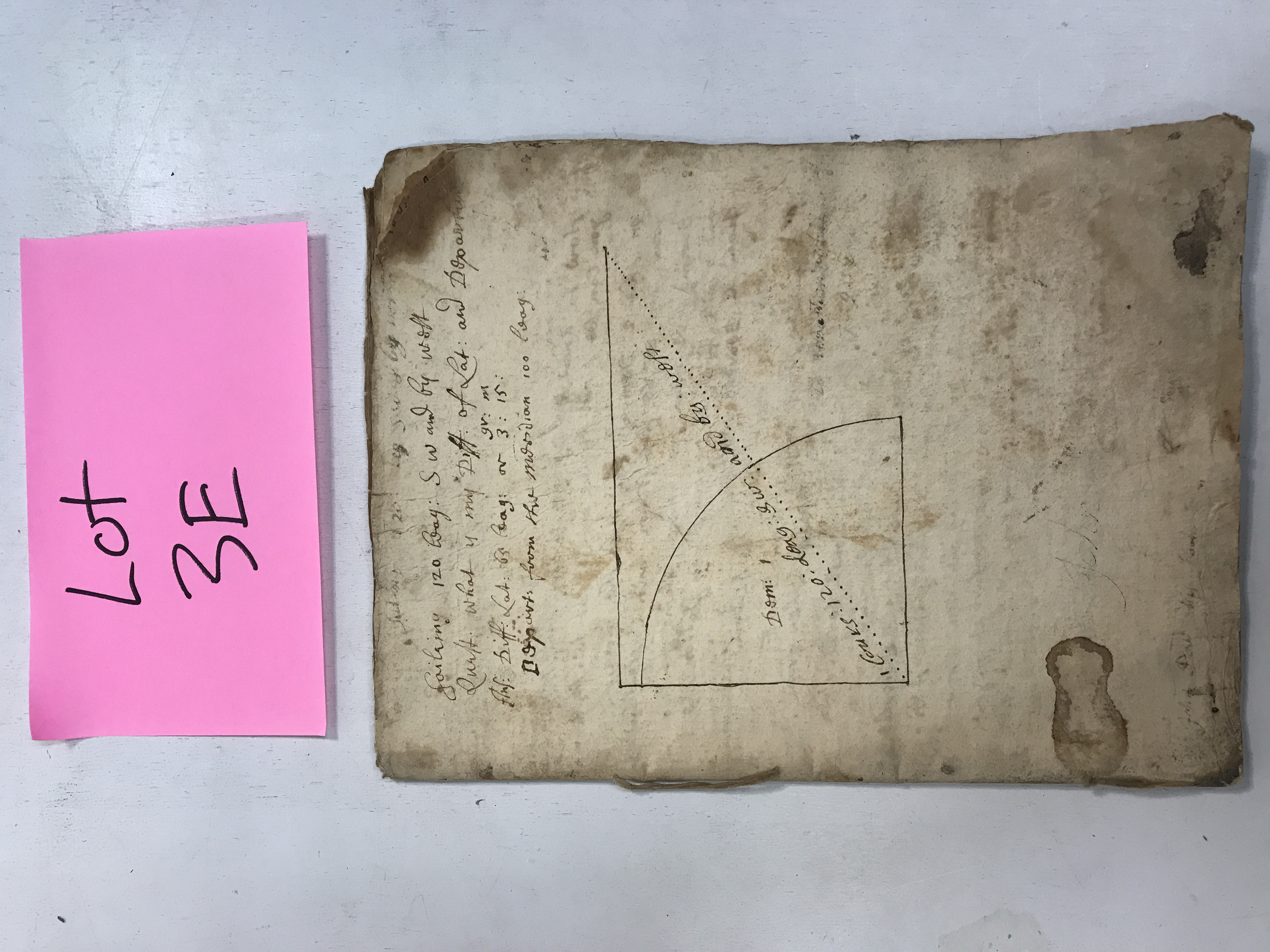
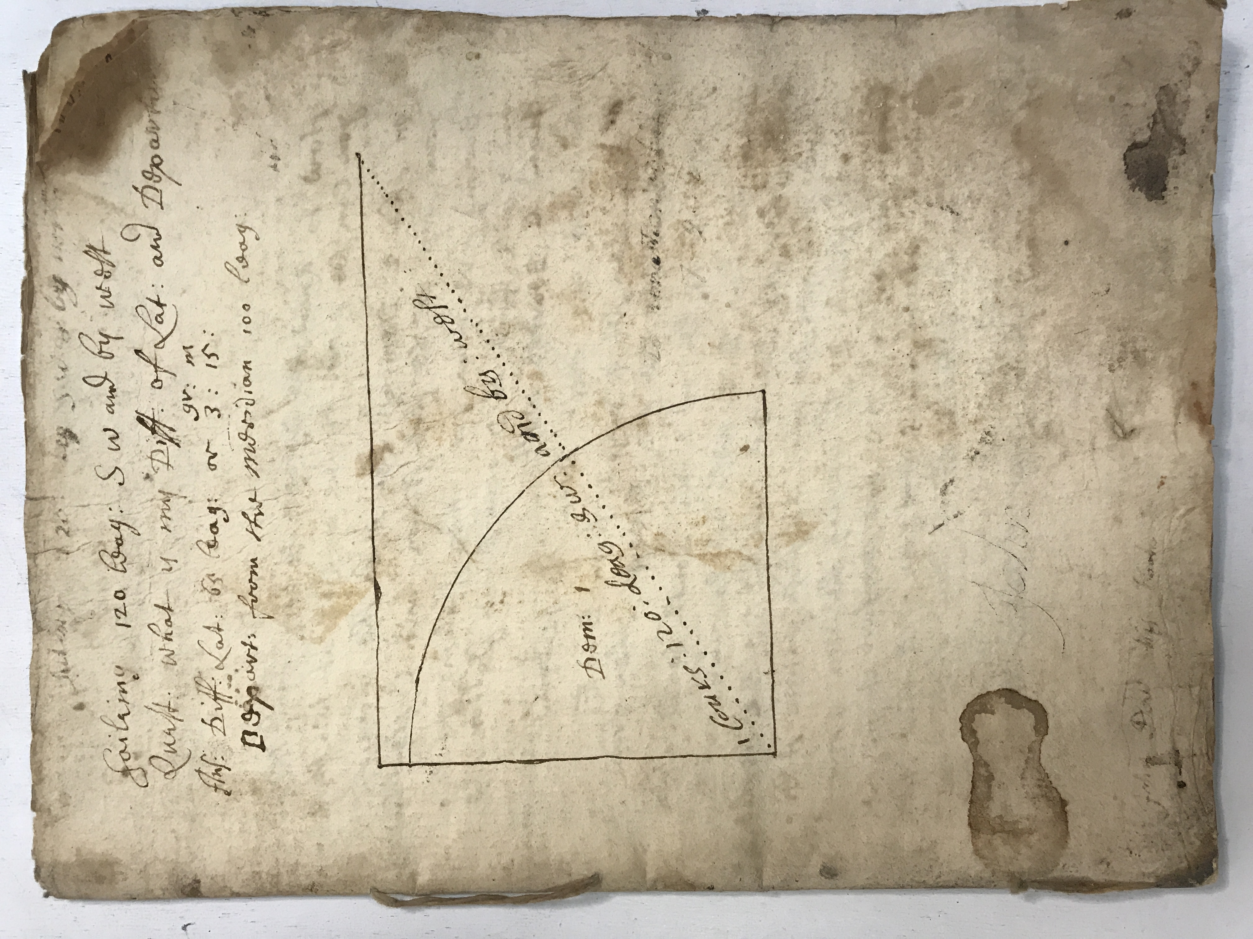
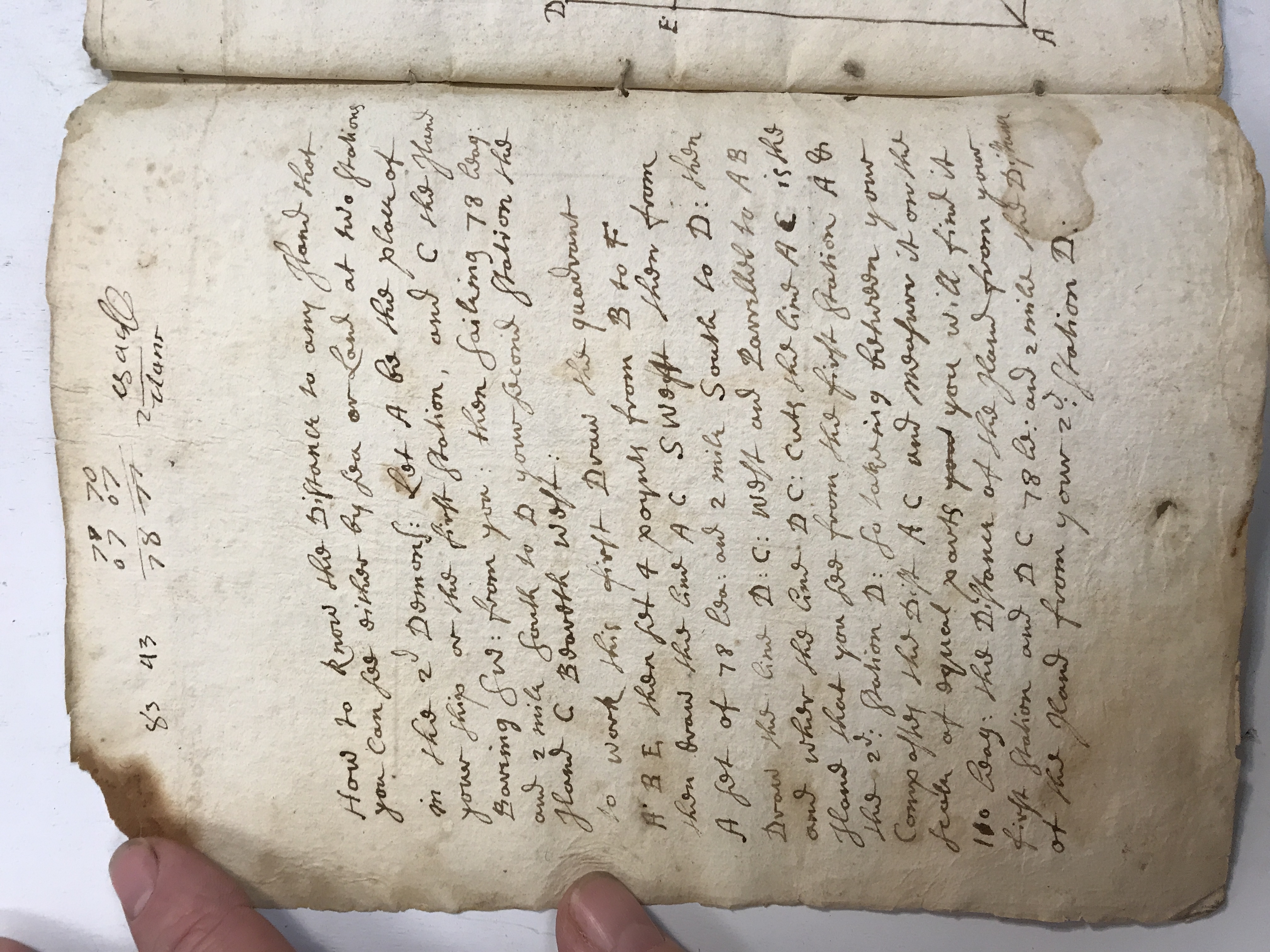
The Lot 3E label introduces a manuscript exercise book with a compass-course diagram on its exposed leaf. Questions about course, distance, latitude and departure show a practical mathematical curriculum. A prose problem follows, connecting geometry to a vessel’s position.
A navigation notebook and an introductory problem · view 1 of 3
Open full-resolution photograph ↗
A navigation notebook and an introductory problem · view 2 of 3
Open full-resolution photograph ↗
A navigation notebook and an introductory problem · view 3 of 3
Open full-resolution photograph ↗
JDT-D532 · Solving courses by latitude and departure
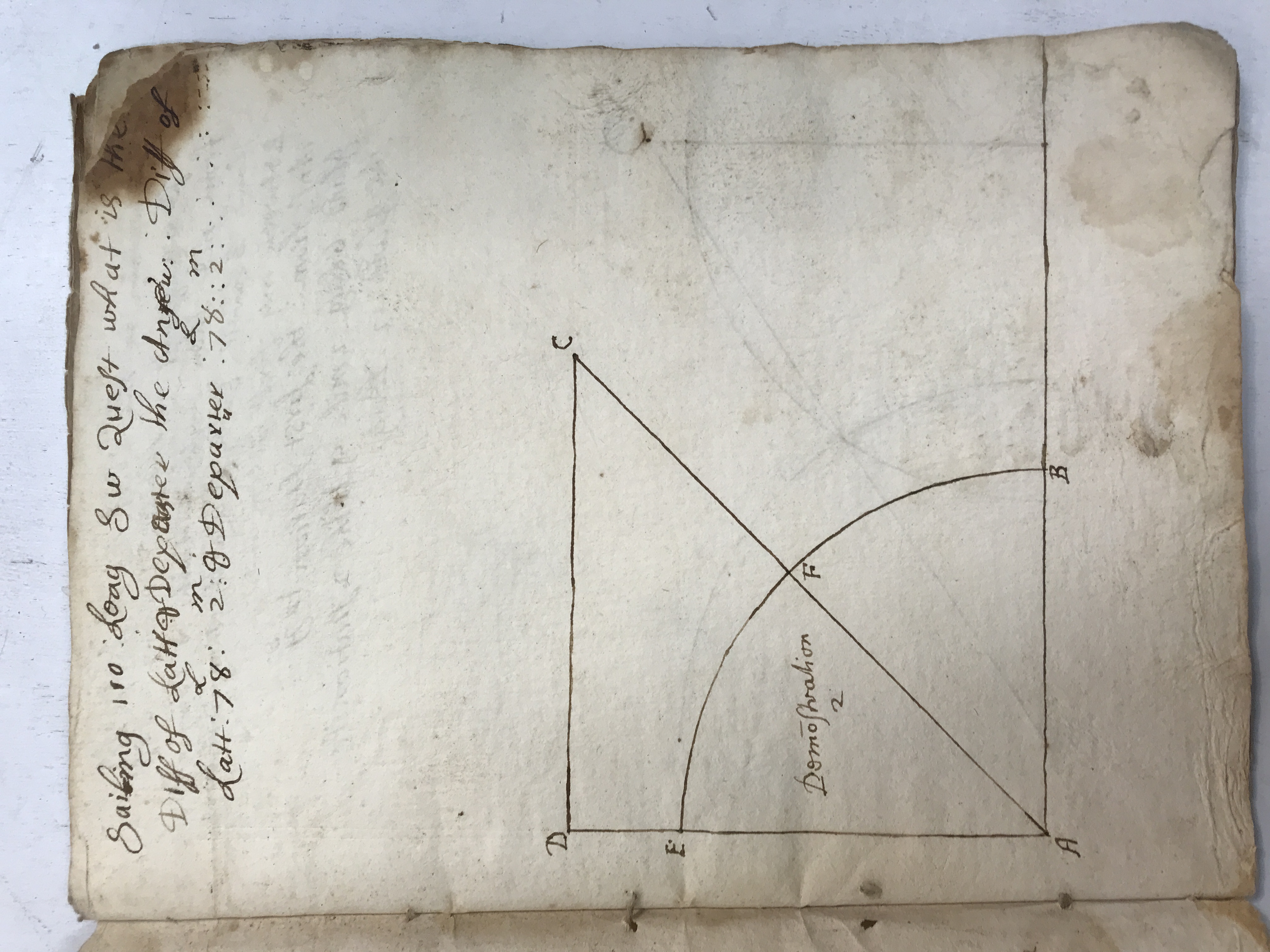
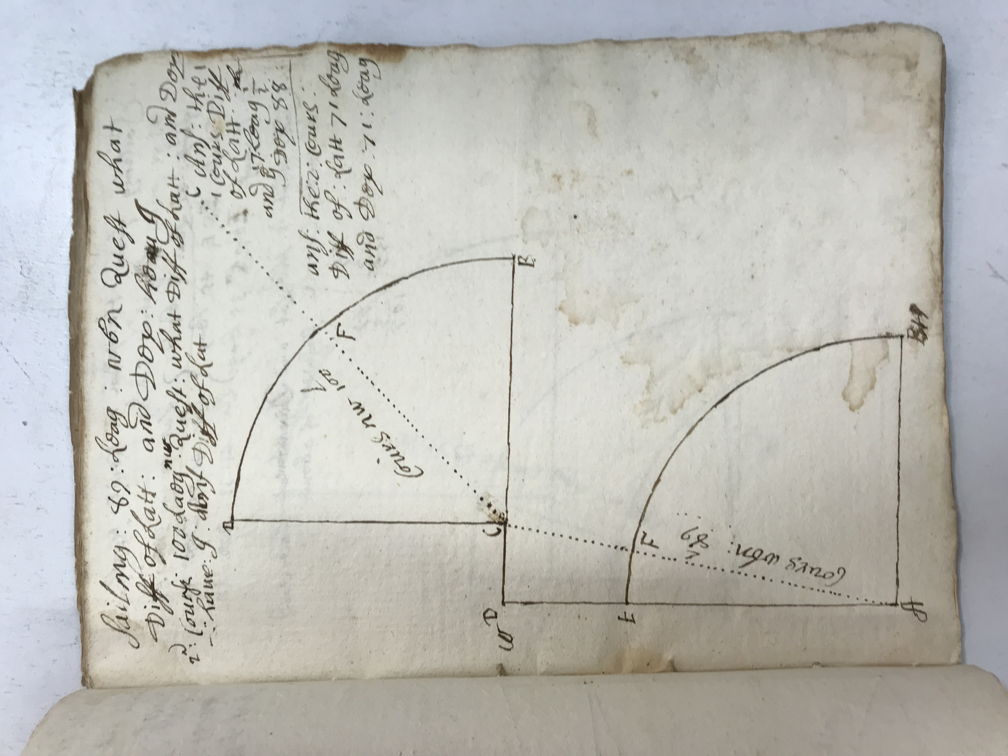
Successive diagrams use quarter-circle arcs, perpendiculars and diagonals to relate a ship’s course to north–south and east–west movement. Worked examples begin with a stated distance and direction and ask for the resulting change in position. The drawings preserve the method as well as its numerical answers.
Solving courses by latitude and departure · view 1 of 4
Open full-resolution photograph ↗
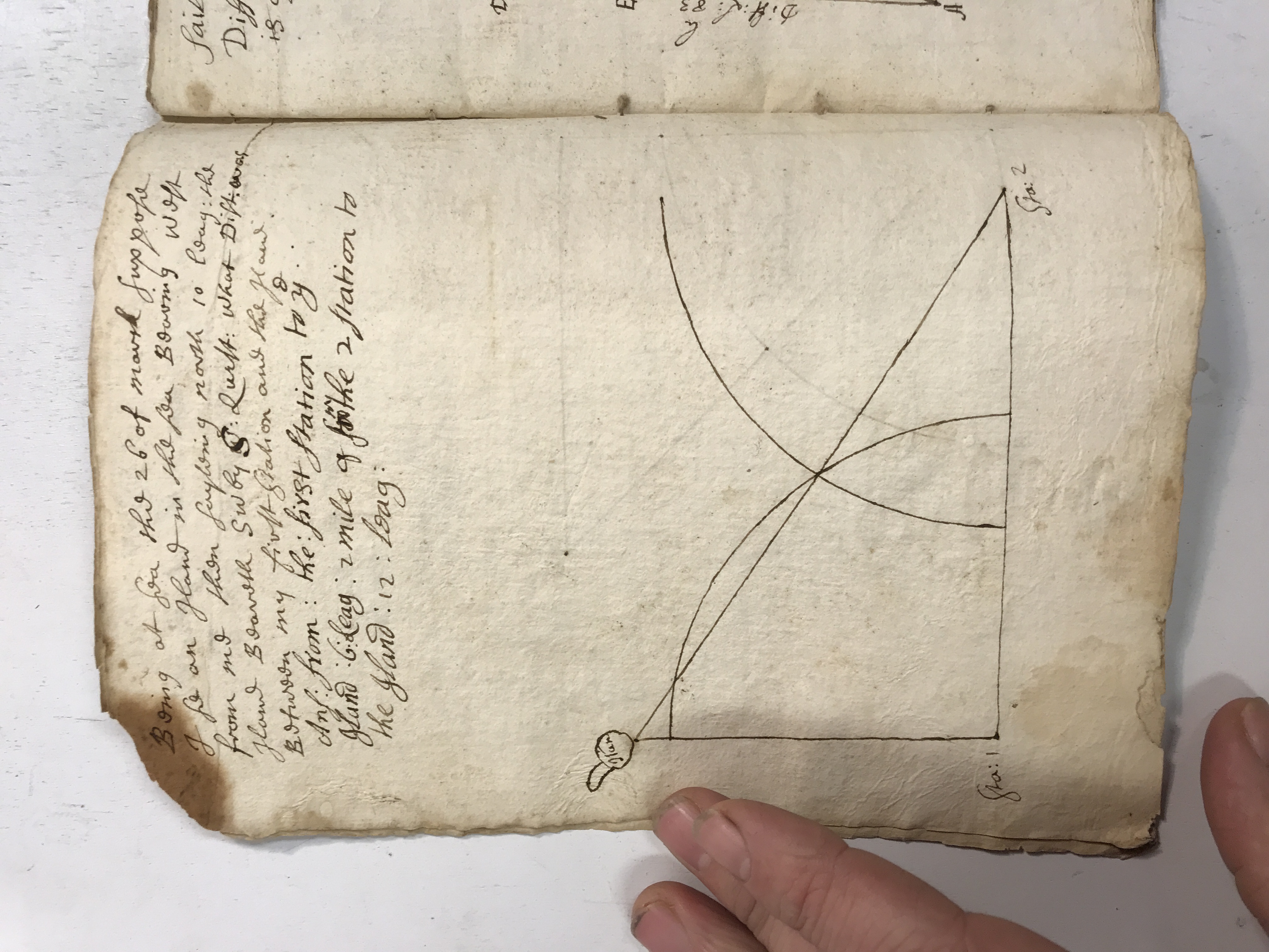
Solving courses by latitude and departure · view 2 of 4
Open full-resolution photograph ↗
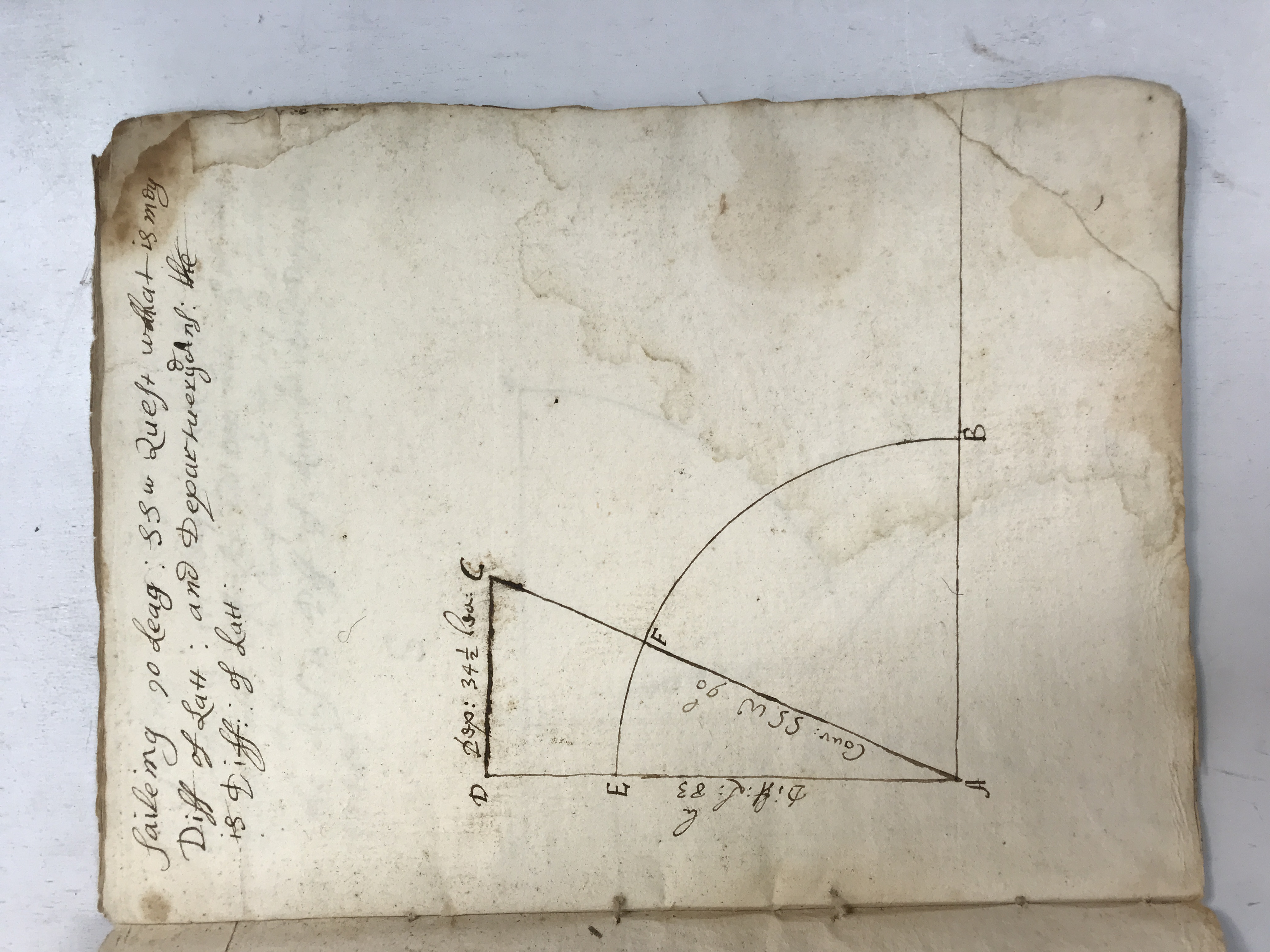
Solving courses by latitude and departure · view 3 of 4
Open full-resolution photograph ↗
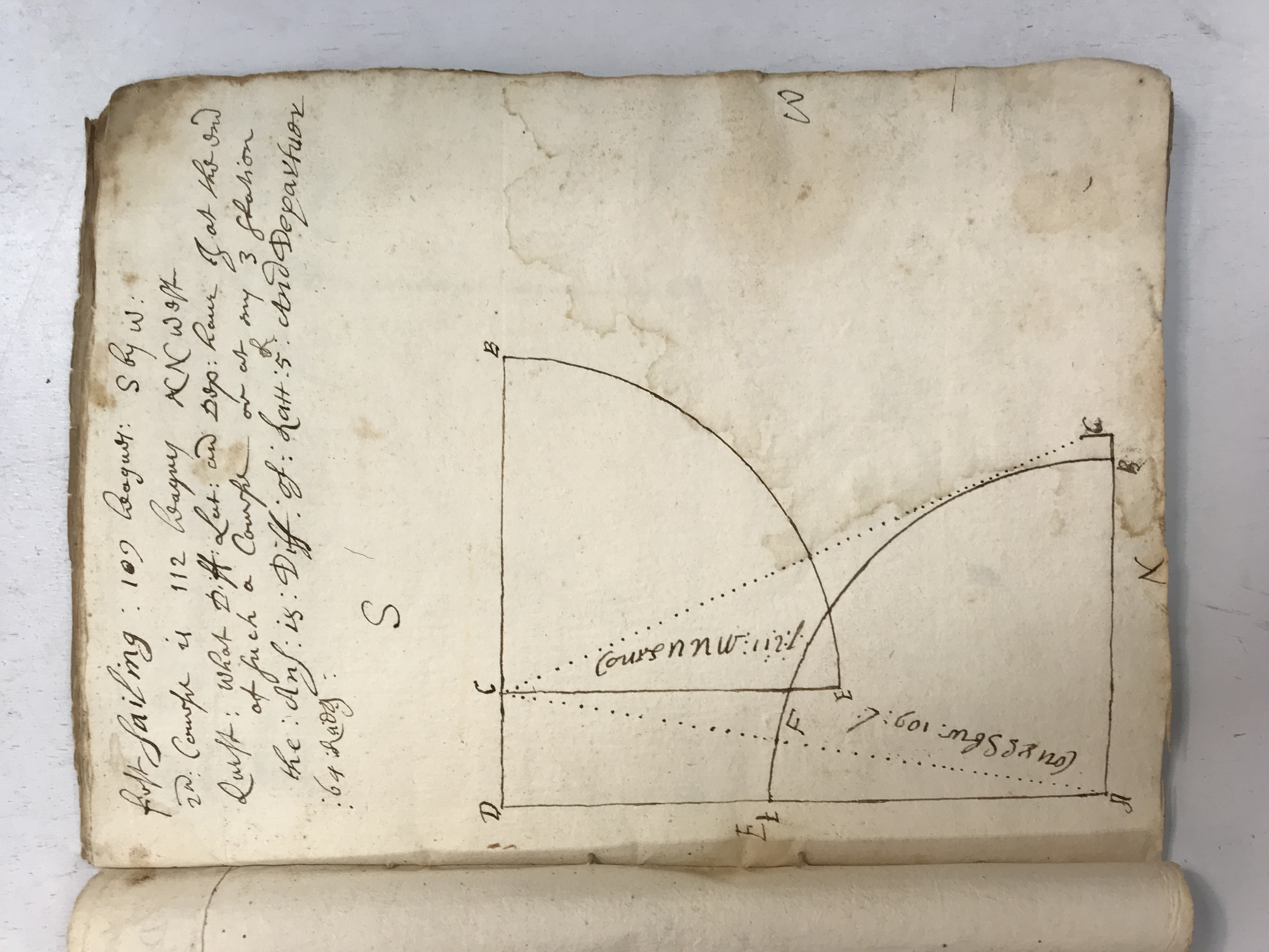
Solving courses by latitude and departure · view 4 of 4
Open full-resolution photograph ↗
JDT-D533 · Compound courses and linked diagrams
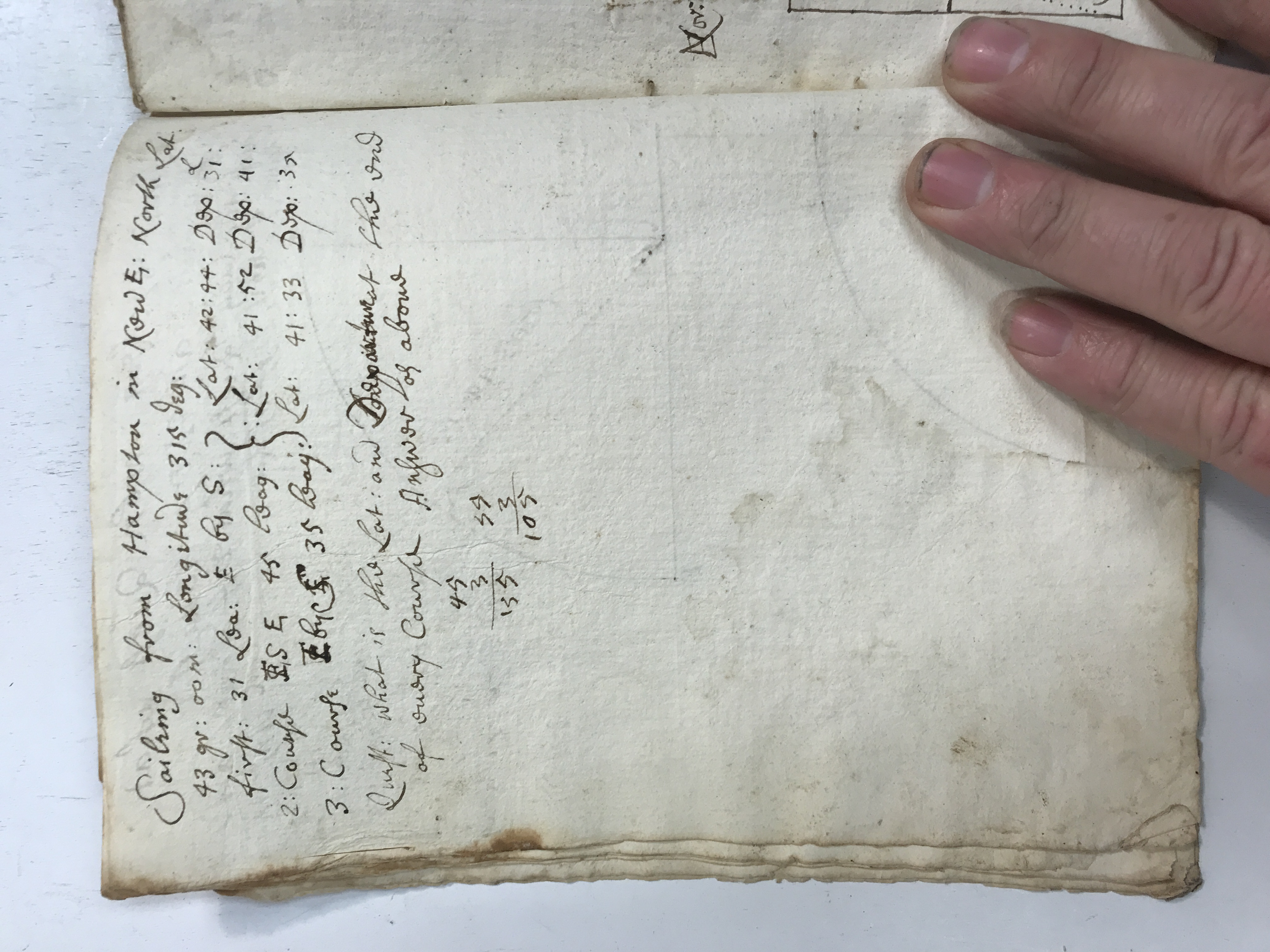
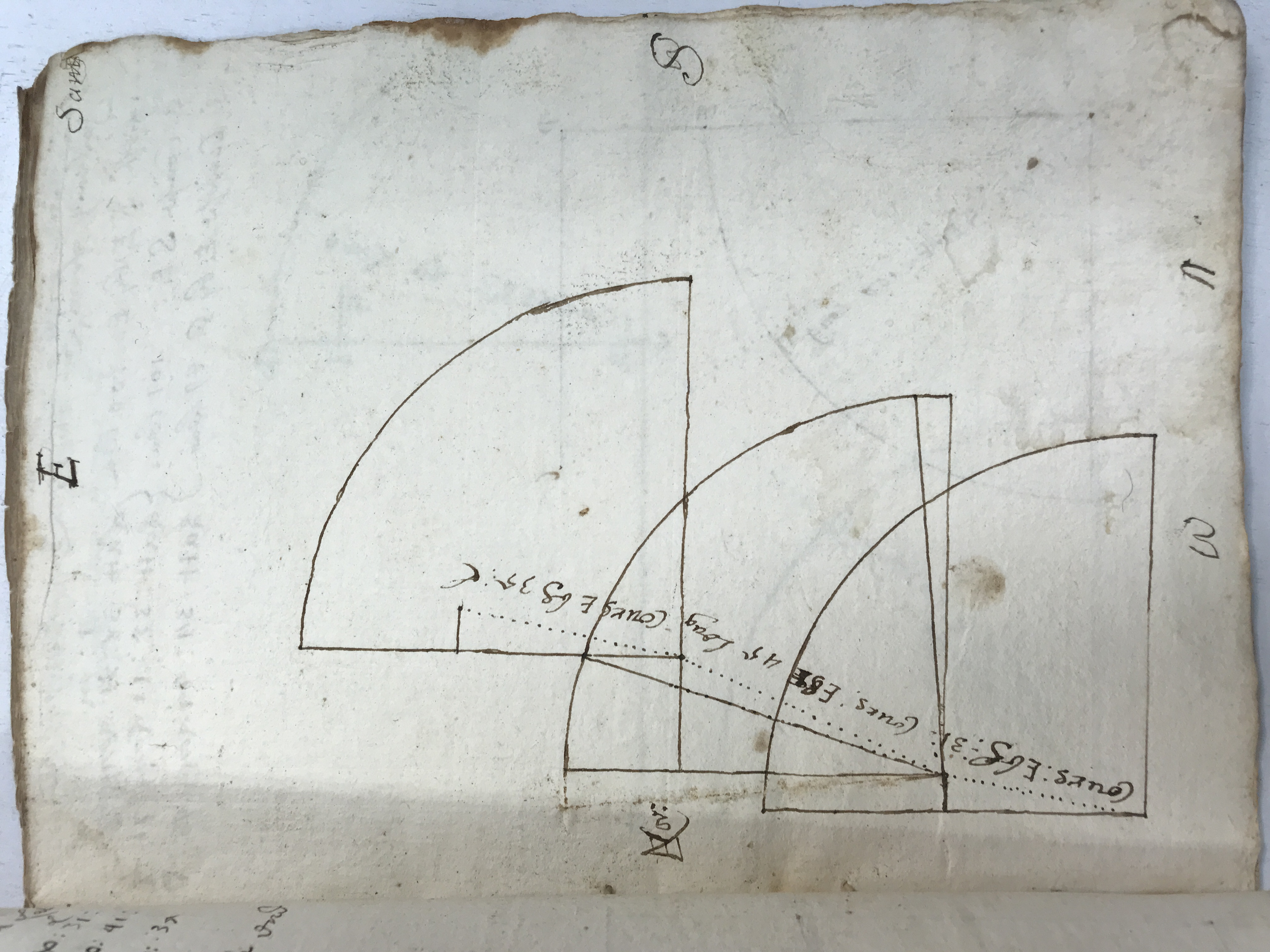
Multiple arcs and dashed lines represent successive legs or combined directions. A worked problem describes sailing from Hampton in New Hampshire and compares the separate courses. These are mathematical exercises; their presence does not by itself prove the notebook keeper made the voyages.
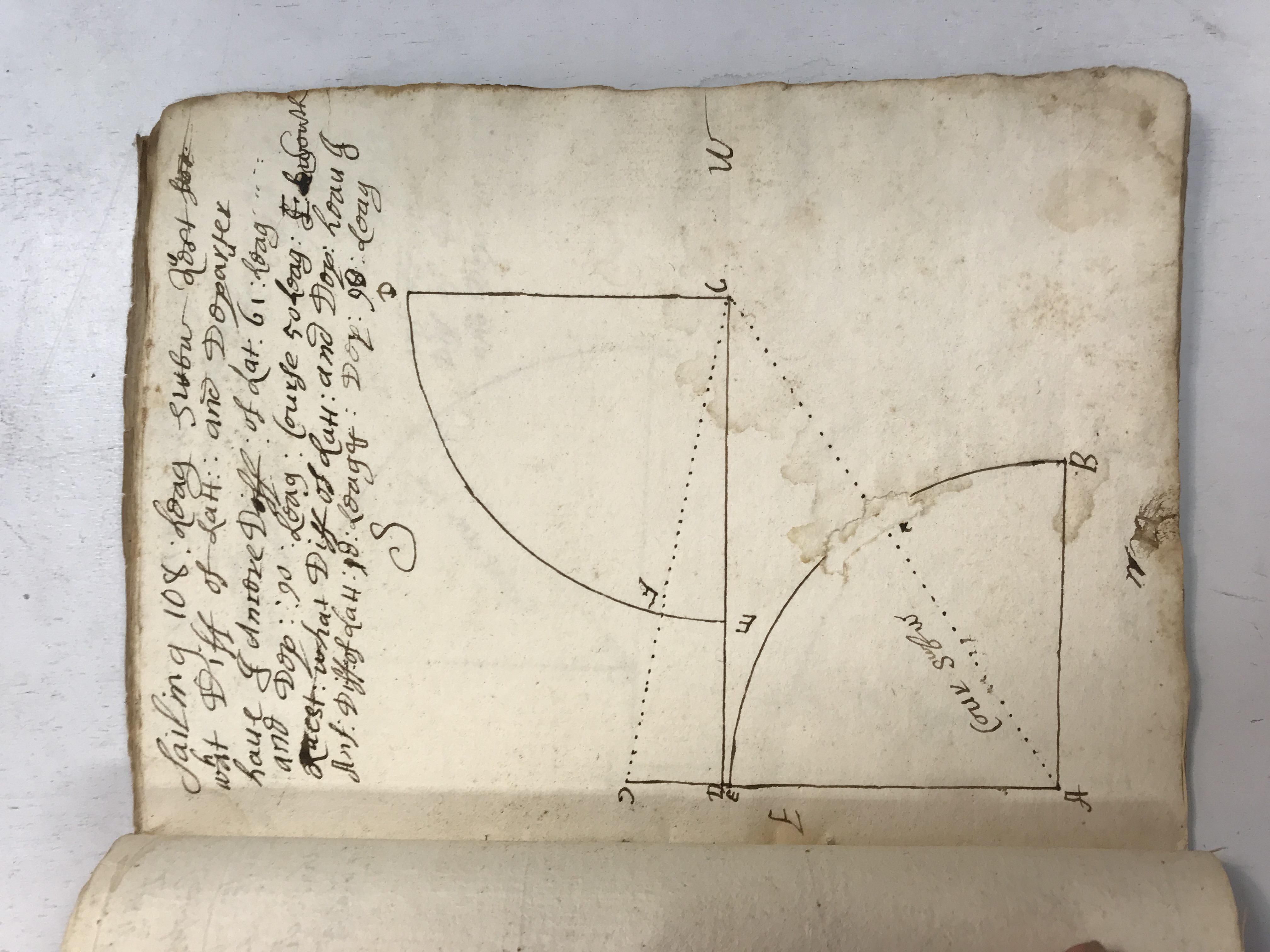
Compound courses and linked diagrams · view 1 of 4
Open full-resolution photograph ↗
Compound courses and linked diagrams · view 2 of 4
Open full-resolution photograph ↗
Compound courses and linked diagrams · view 3 of 4
Open full-resolution photograph ↗
Compound courses and linked diagrams · view 4 of 4
Open full-resolution photograph ↗
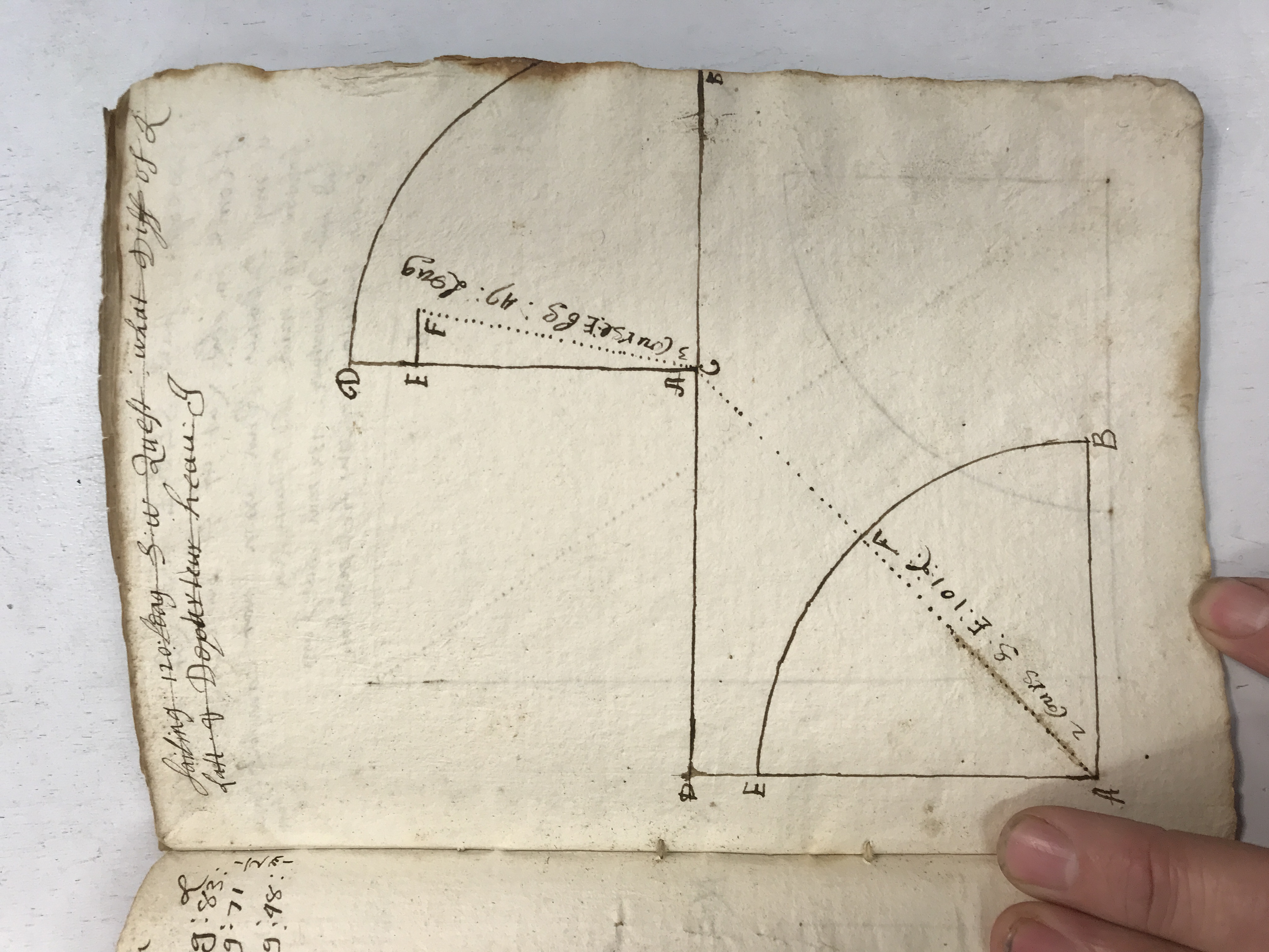
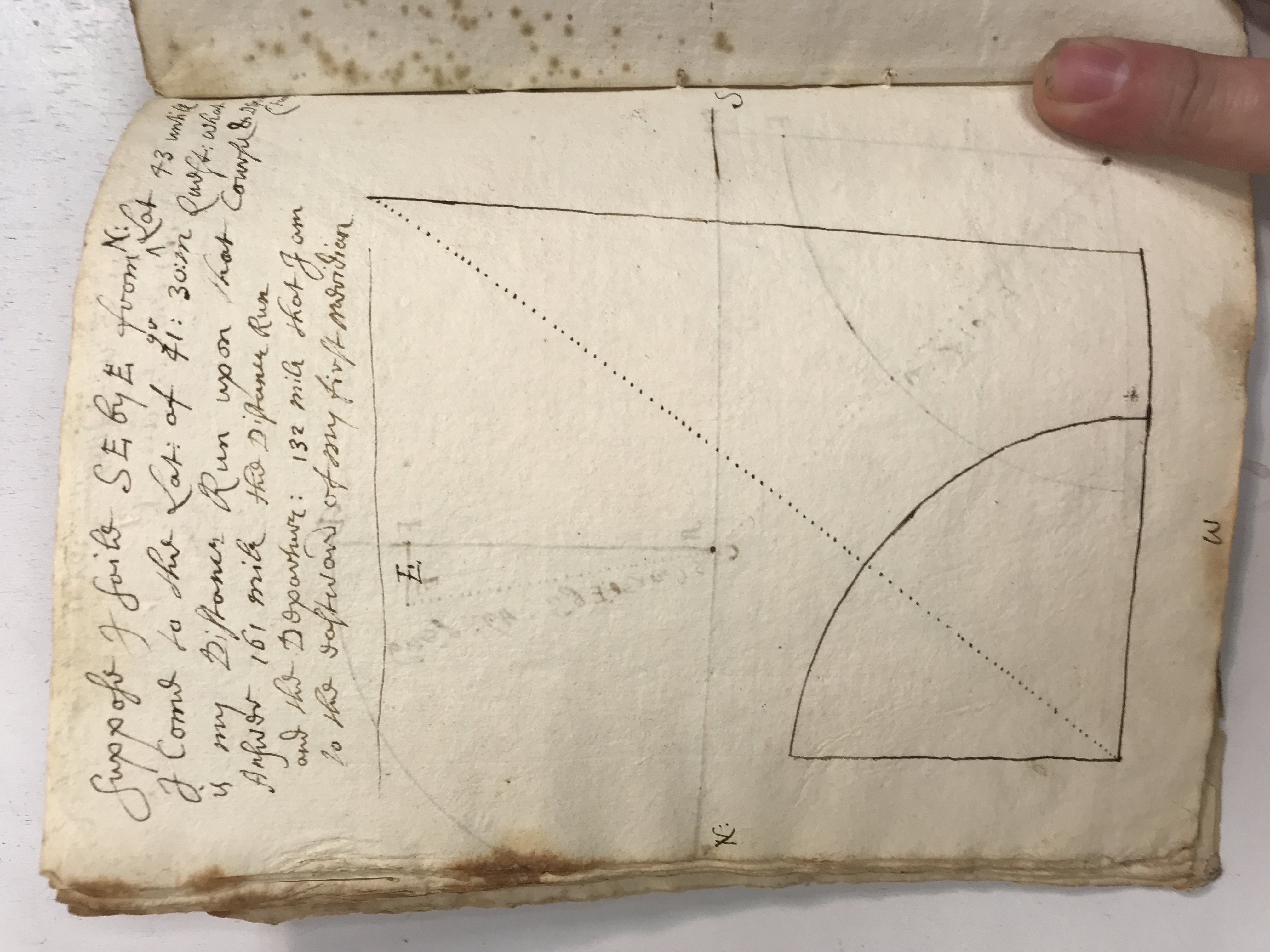
JDT-D534 · Further sailing problems and geometric construction
The pages continue with course-and-distance questions and carefully drawn solutions. Labels around the arcs retain the compass orientation, while dotted lines distinguish projected distances from the main course. Each view contributes a different construction rather than repeating one illustration.
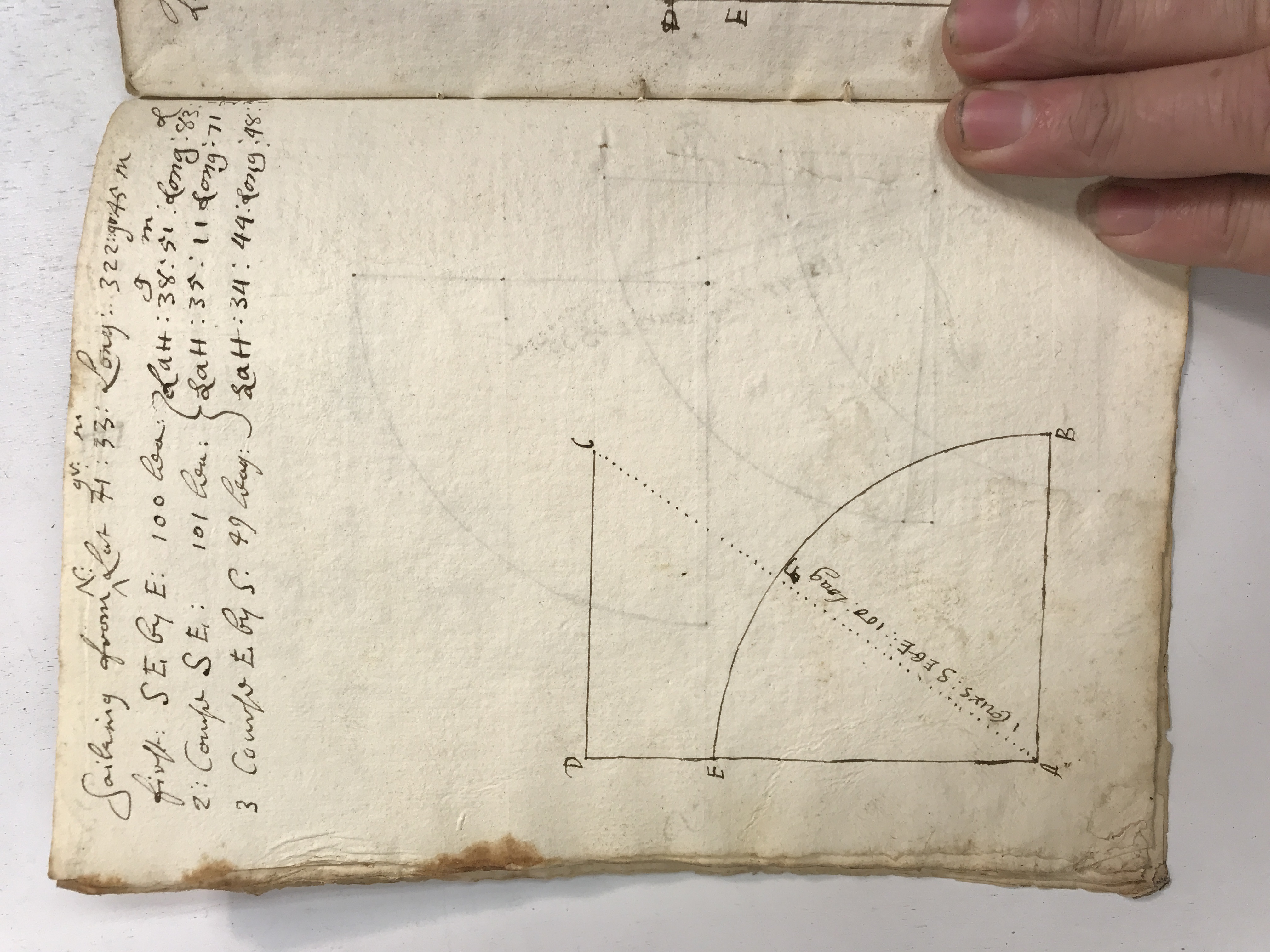
Further sailing problems and geometric construction · view 1 of 3
Open full-resolution photograph ↗
Further sailing problems and geometric construction · view 2 of 3
Open full-resolution photograph ↗
Further sailing problems and geometric construction · view 3 of 3
Open full-resolution photograph ↗
JDT-D535 · A worked journal from London toward New England
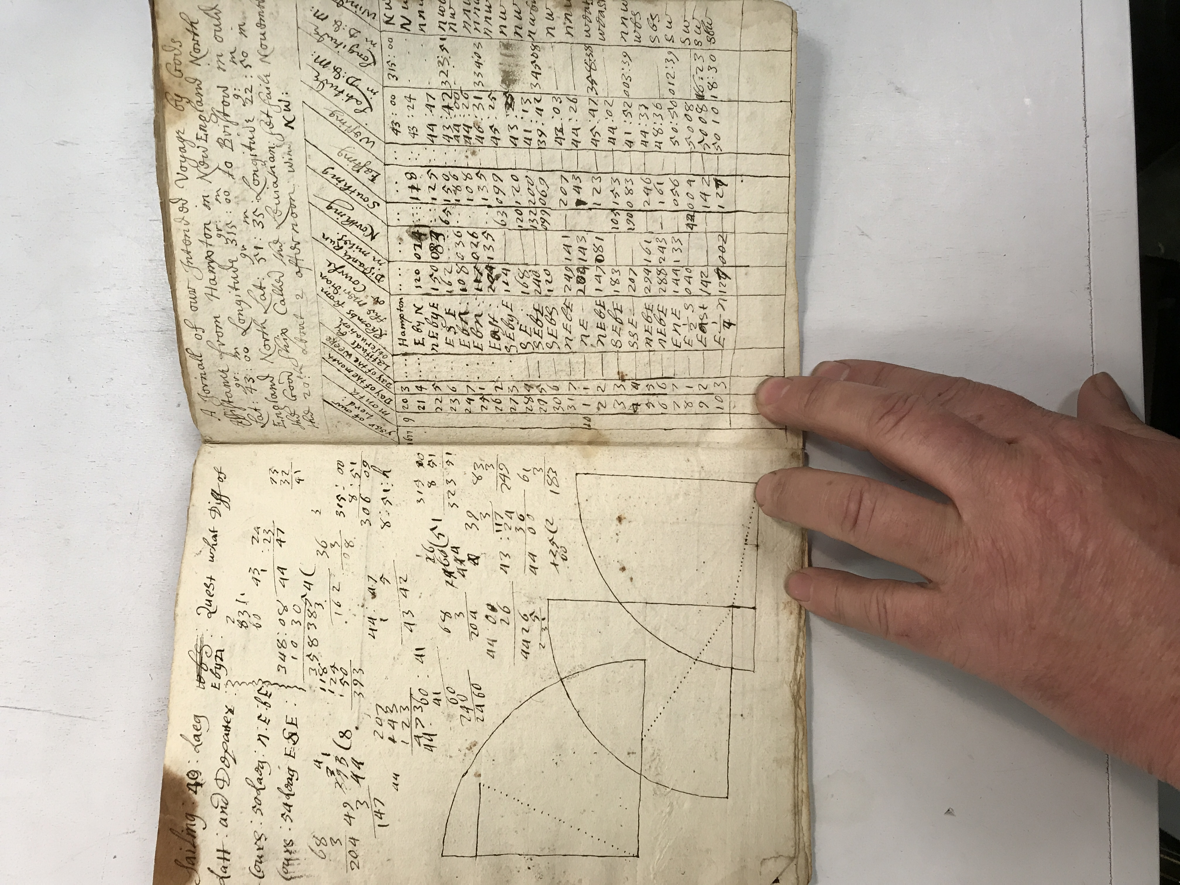
A tabulated sailing journal is headed as a journey from London in Old England toward Boston in New England. Daily course, distance, latitude and longitude columns accompany the calculation. It is presented here as a worked navigation record within an exercise book, without claiming it documents an independently verified voyage.
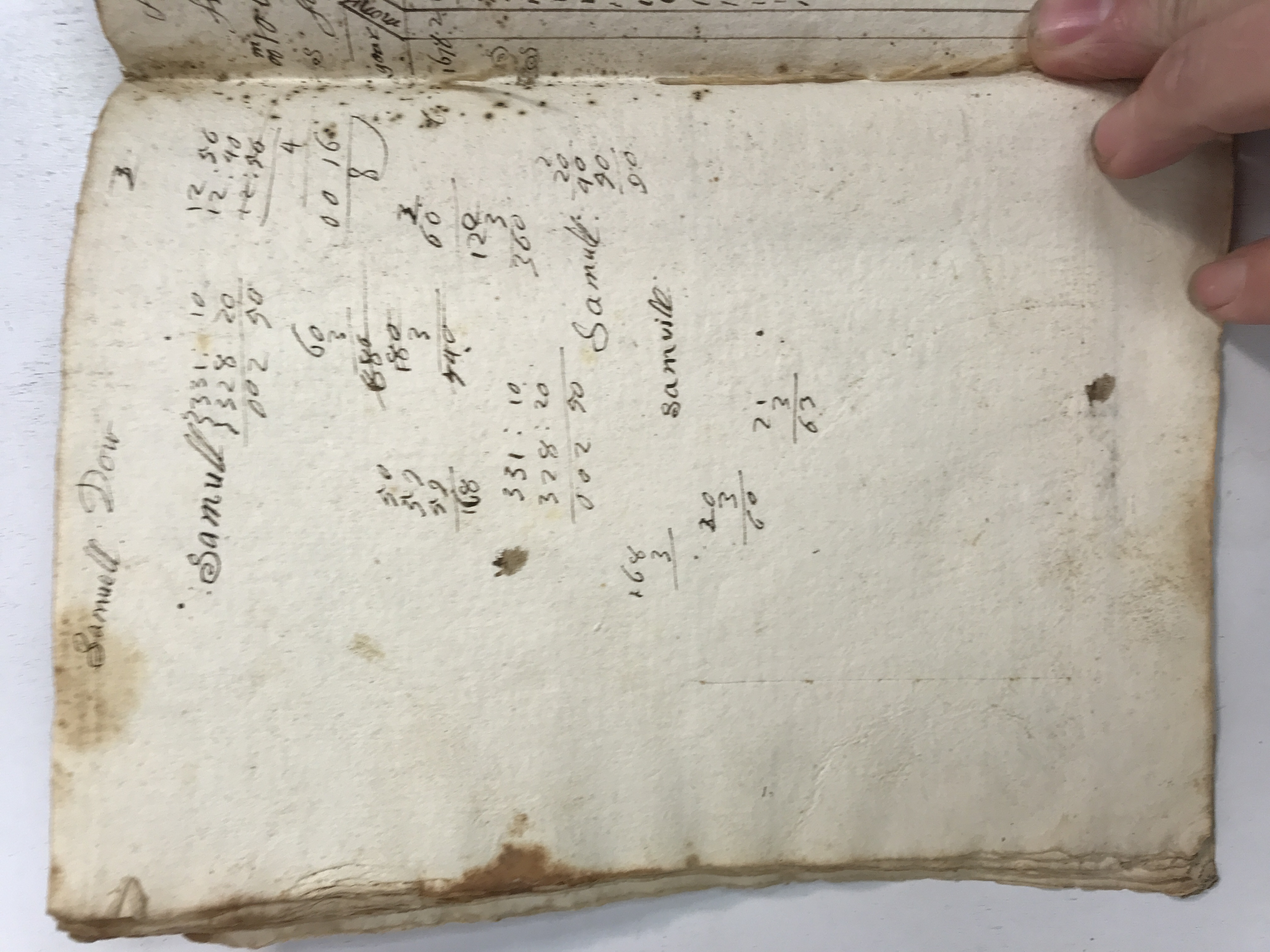
A worked journal from London toward New England · view 1 of 3
Open full-resolution photograph ↗
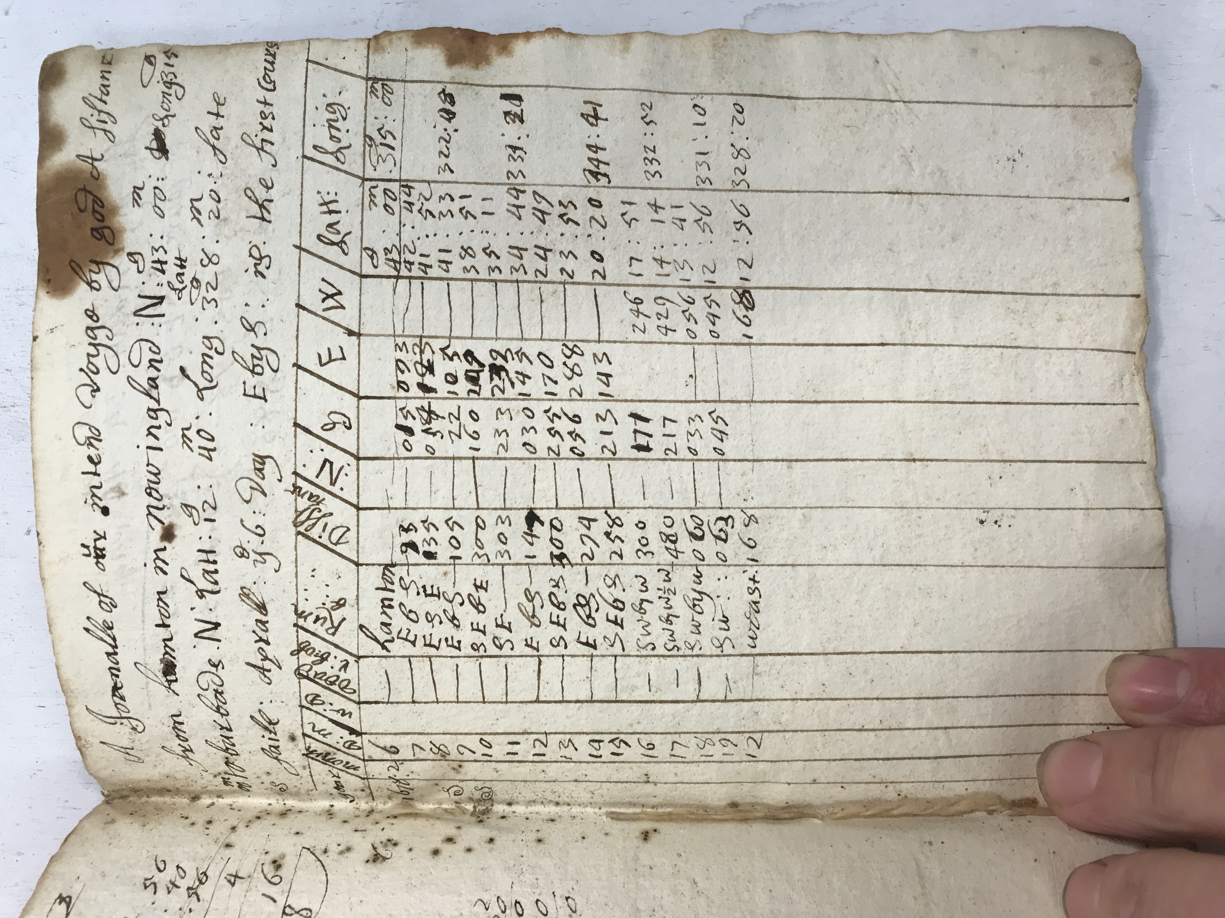
A worked journal from London toward New England · view 2 of 3
Open full-resolution photograph ↗
A worked journal from London toward New England · view 3 of 3
Open full-resolution photograph ↗
JDT-D536 · Navigation tables beside plotted solutions
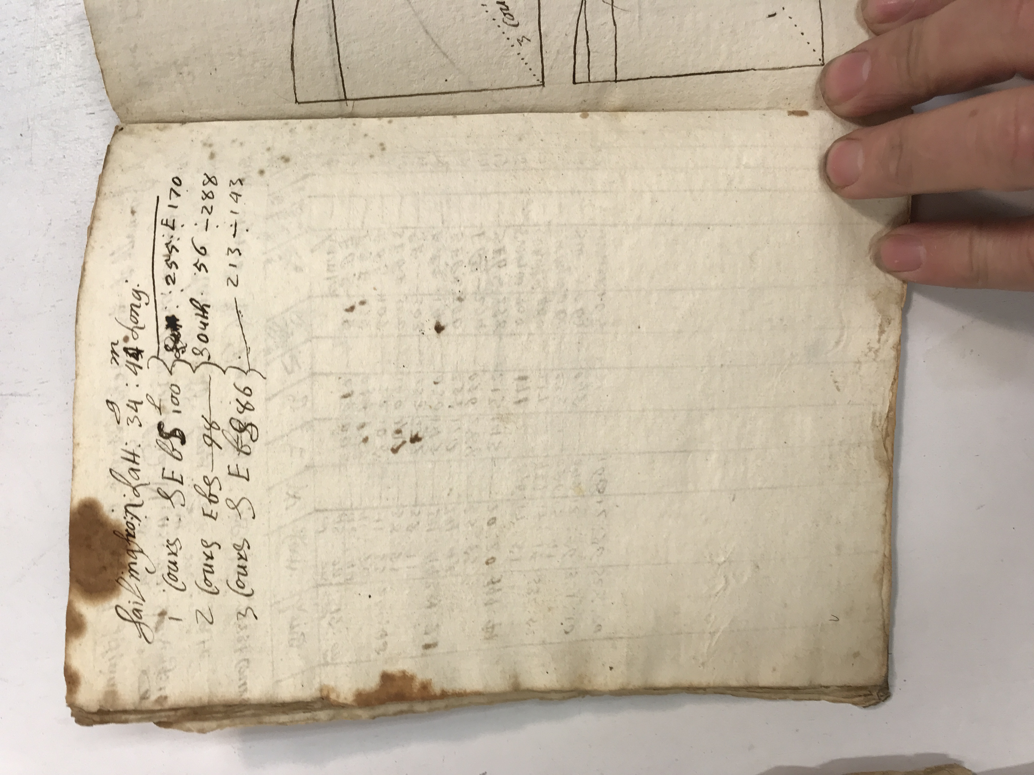
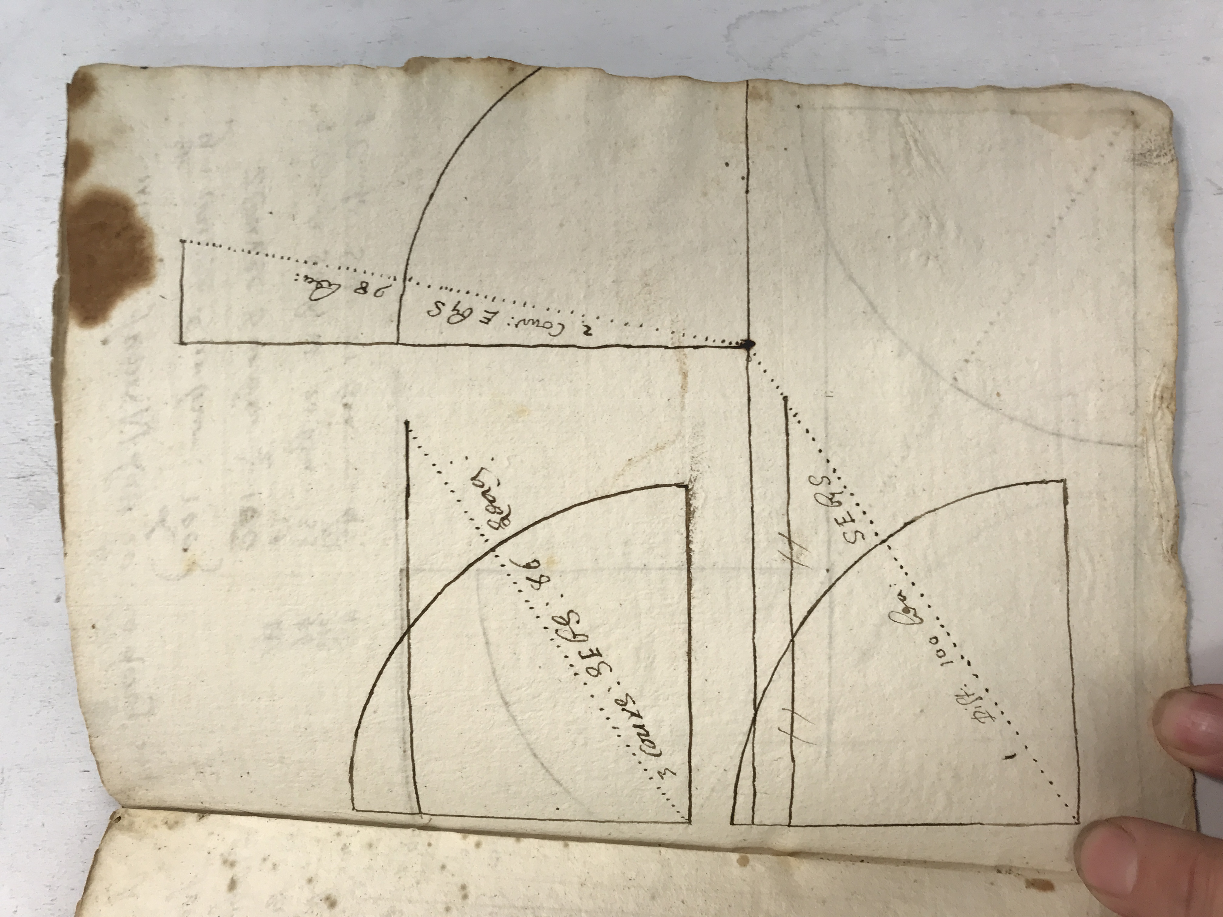
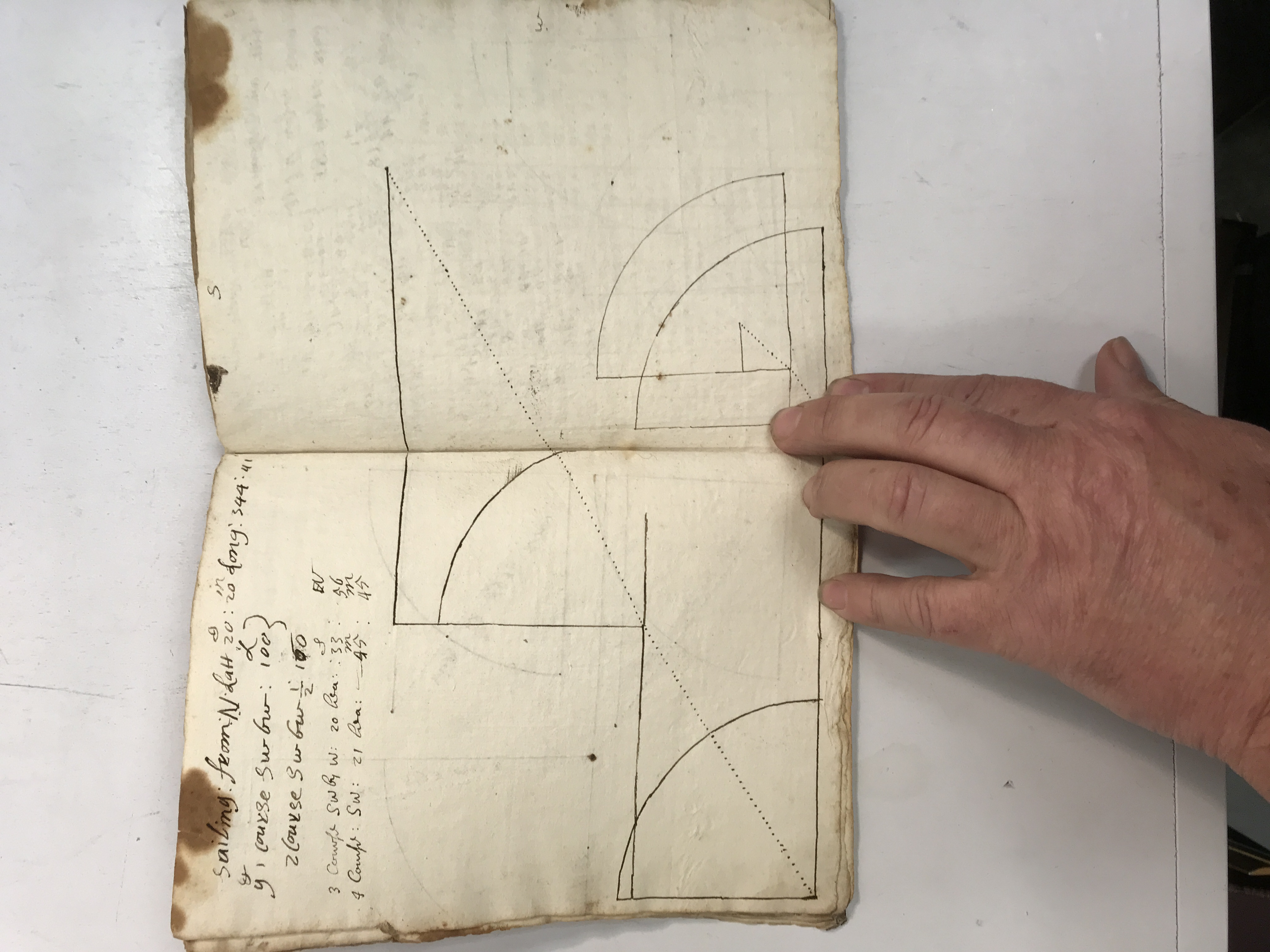
Openings show numerical work and diagrams together. The relationship between the table and plotted lines makes visible the intermediate labor behind a position calculation. Photographs showing the whole spread help preserve connections that a close crop of one diagram would lose.
Navigation tables beside plotted solutions · view 1 of 4
Open full-resolution photograph ↗
Navigation tables beside plotted solutions · view 2 of 4
Open full-resolution photograph ↗
Navigation tables beside plotted solutions · view 3 of 4
Open full-resolution photograph ↗
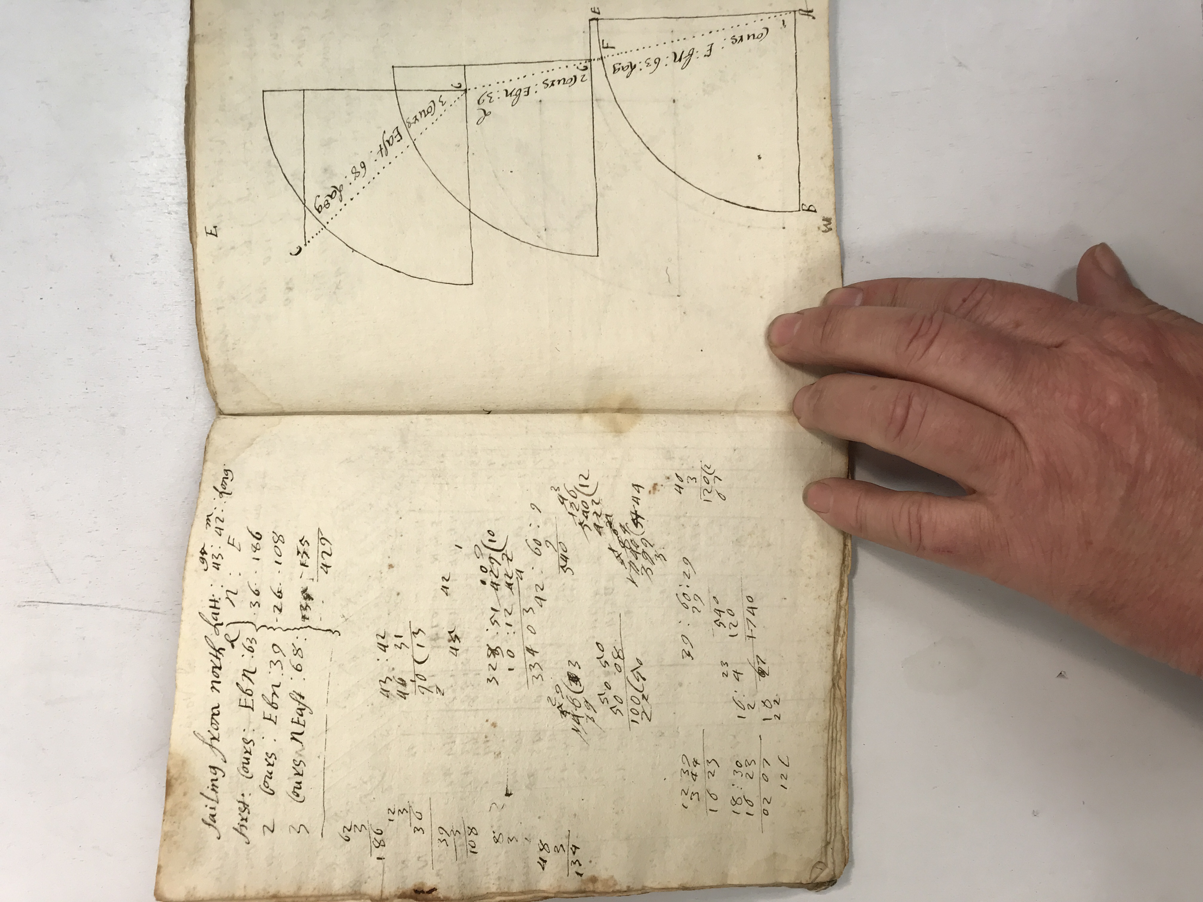
Navigation tables beside plotted solutions · view 4 of 4
Open full-resolution photograph ↗
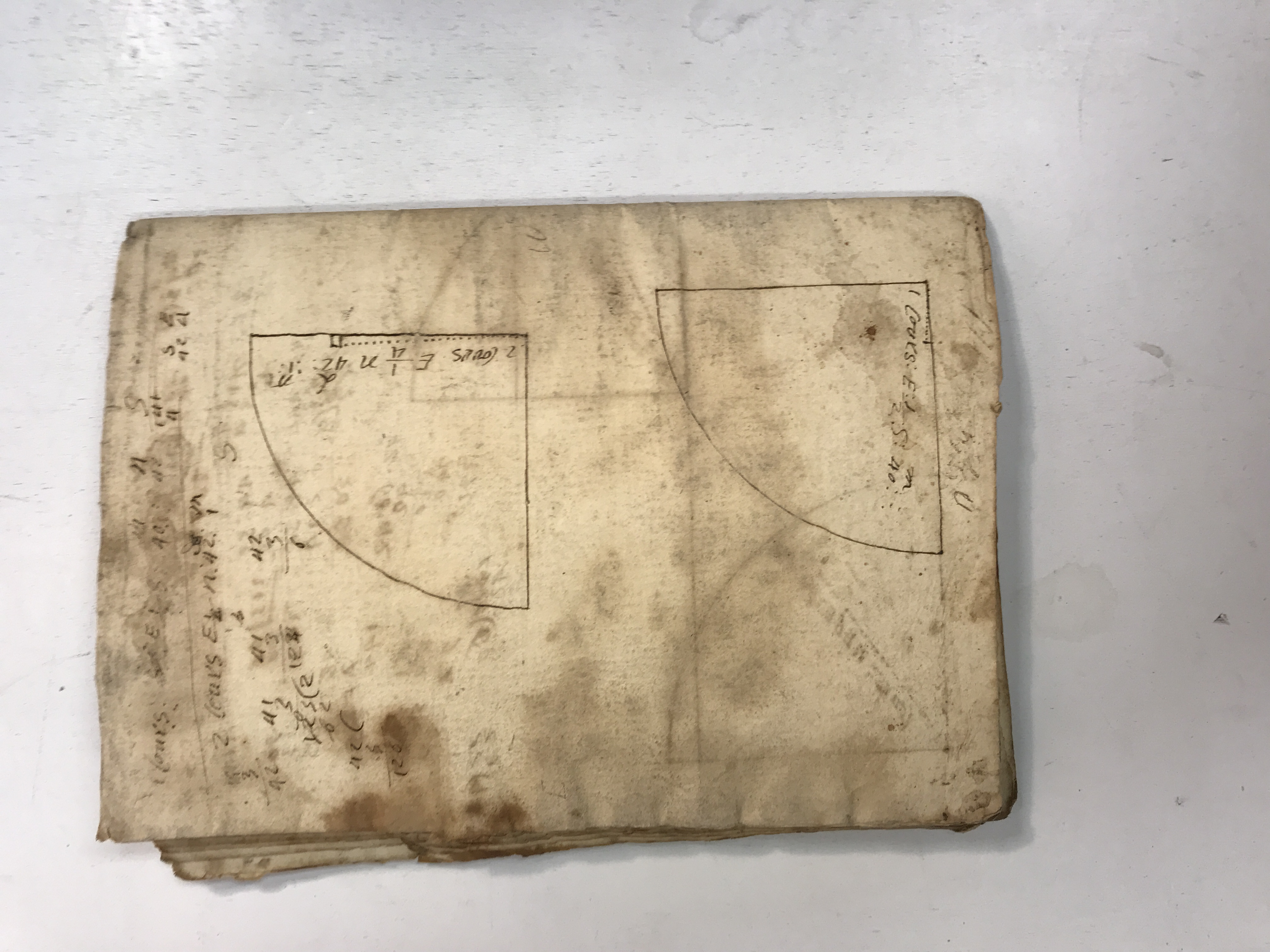
JDT-D537 · Final calculations and the notebook’s worn outer leaf
The last photographed spreads continue the geometric problems and accompanying arithmetic. The outer leaf bears diagrams beneath staining and wear, showing that the book’s working surfaces extend to its covers. Original photographs remain available for examining faint pencil and ink.
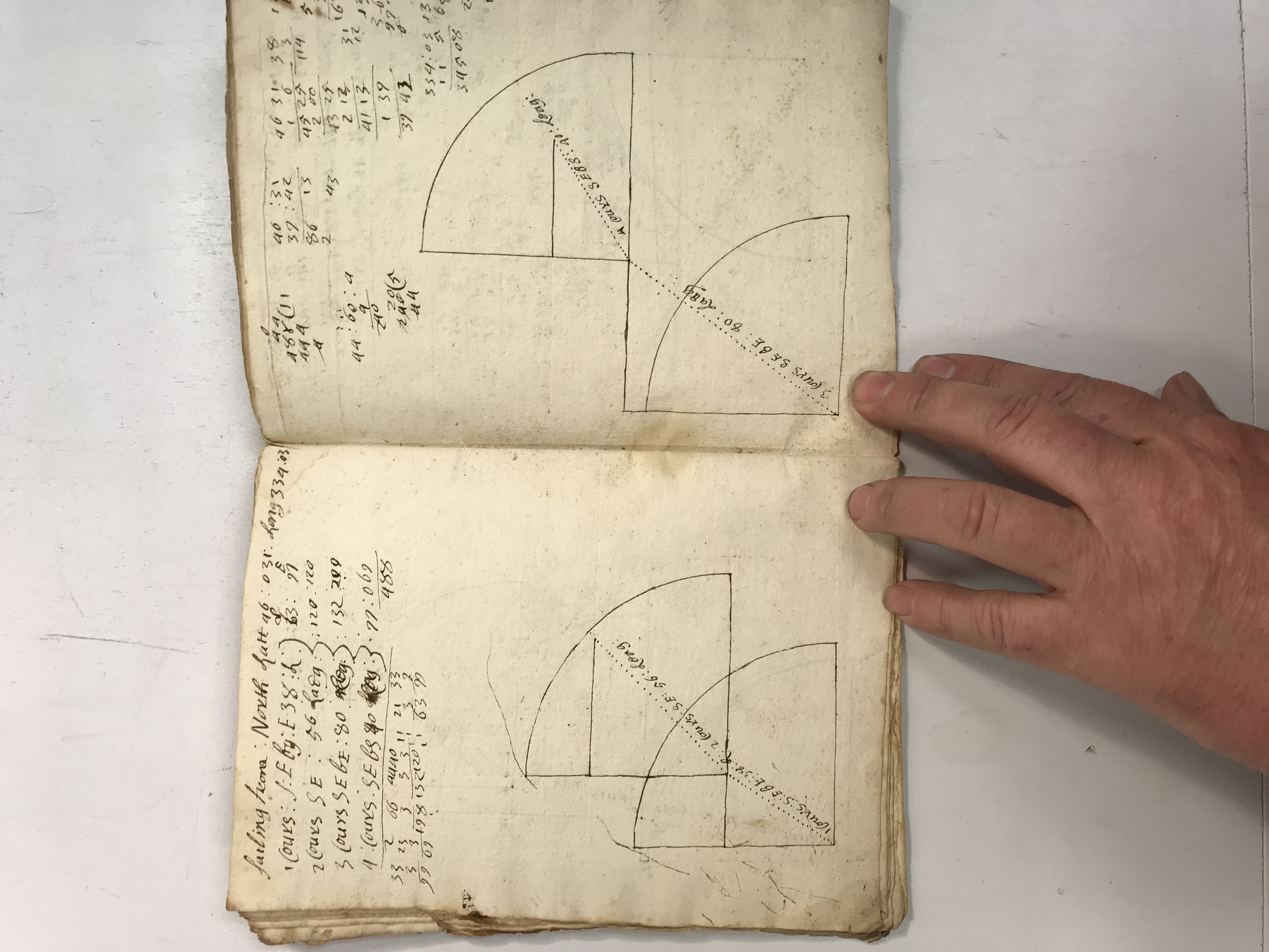
Final calculations and the notebook’s worn outer leaf · view 1 of 4
Open full-resolution photograph ↗
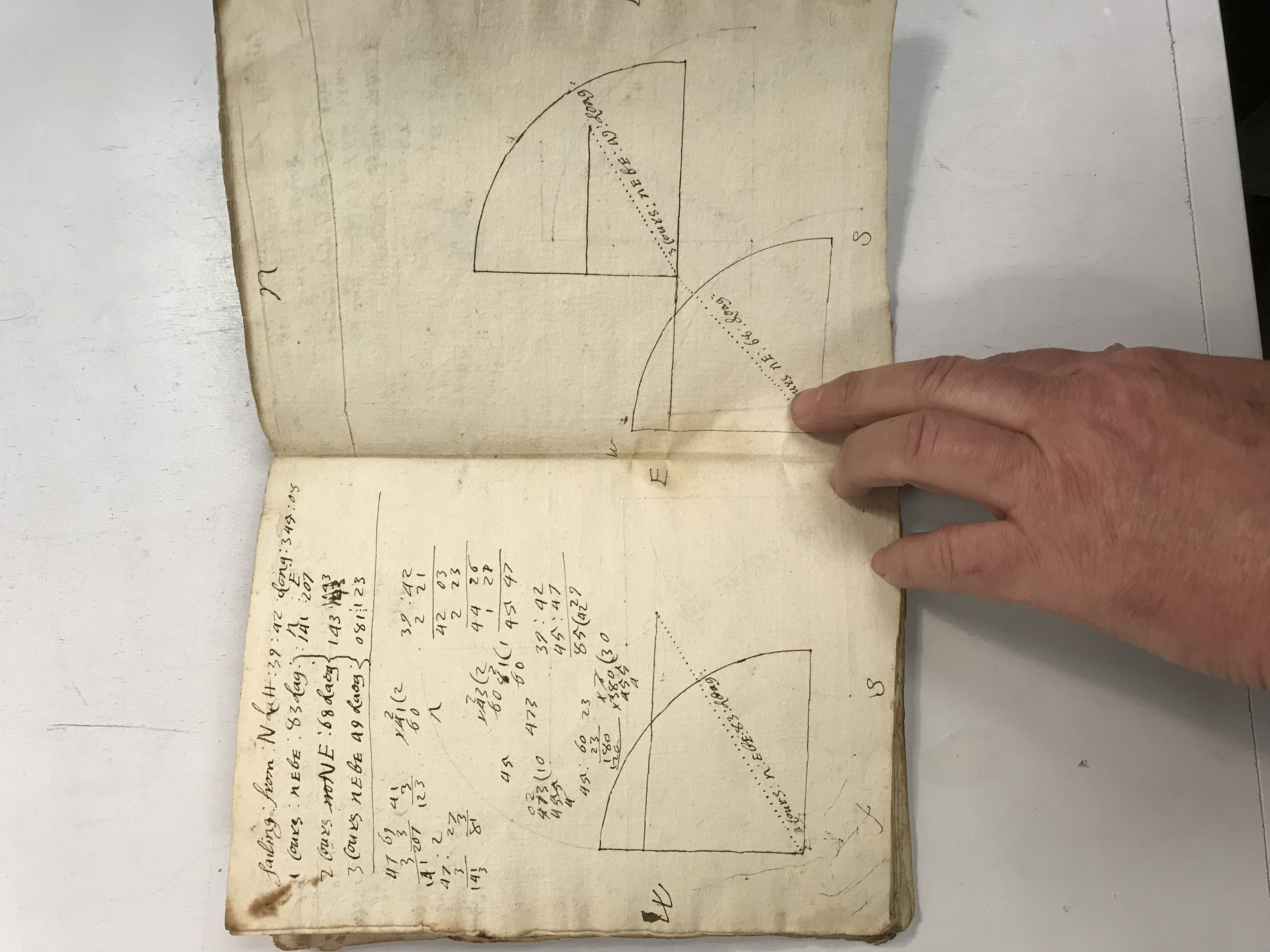
Final calculations and the notebook’s worn outer leaf · view 2 of 4
Open full-resolution photograph ↗
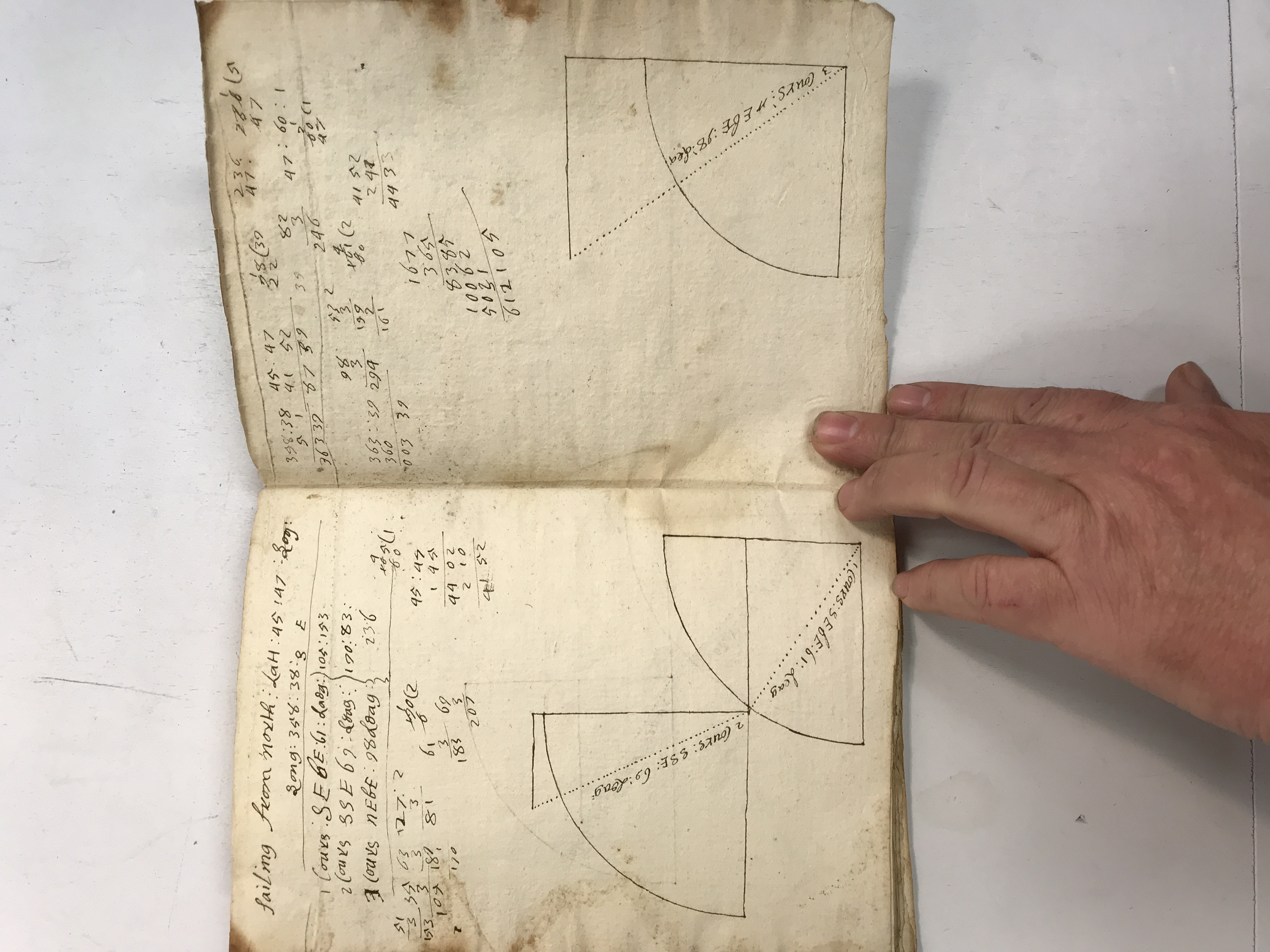
Final calculations and the notebook’s worn outer leaf · view 3 of 4
Open full-resolution photograph ↗
Final calculations and the notebook’s worn outer leaf · view 4 of 4
Open full-resolution photograph ↗
Collection photographs supplied by Whit. Descriptions are finding aids, not full transcriptions. Names, dates and associations remain provisional where the handwriting is uncertain.